Drone GIS Services in Saudi Arabia
Saudi Arabia is currently undergoing a historic digital and physical transformation. From the heights of the Trojena mountains to the innovative urban layouts of NEOM’s The Line, the demand for precise, real-time spatial data has never been higher.
At Drone Tech, we specialize in providing cutting-edge Drone GIS Services in Saudi Arabia, bridging the gap between raw aerial data and actionable geographic intelligence. Our mission is to support the Kingdom’s defense, construction, and environmental sectors by turning every flight into a data-driven roadmap for success.
Looking for the right drone for your needs?
Explore a curated selection of drones and specialized solutions from our store.
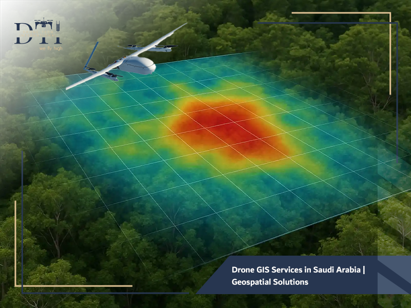
What are Geographic Information Systems (GIS)?
A Geographic Information System (GIS) is a conceptualized framework that provides the ability to capture and analyze spatial and geographic data. Essentially, it is a “smart map” that connects data to a map, integrating location data (where things are) with all types of descriptive information (what things are like there).
This allows users to visualize, question, and interpret data to understand relationships, patterns, and trends. When combined with modern UAV technology, GIS becomes a powerhouse for decision-making, allowing stakeholders to manage assets with unprecedented clarity.
For advanced surveying and high-accuracy data capture, explore our LiDAR drone services for projects in KSA.
How Drones Support GIS Services in Saudi Arabia
In the vast and often challenging terrains of the Kingdom, traditional ground-based data collection can be slow and hazardous. Drones have revolutionized this field by serving as high-speed, high-resolution data acquisition platforms.
By utilizing Drone GIS Services in Saudi Arabia, companies can bypass logistical hurdles. Drones equipped with RTK (Real-Time Kinematic) and PPK (Post-Processed Kinematic) technology ensure centimeter-level accuracy. This data is then fed into GIS software to create:
- Orthomosaic Maps: High-resolution, undistorted images of the site.
- Digital Elevation Models (DEM): Precise representations of the terrain’s height.
- 3D Point Clouds: Millions of data points that form a digital twin of physical structures.
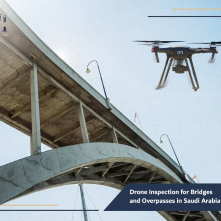
For structural assessment and safer infrastructure checks, explore our drone inspection for bridges and overpasses.
The Role of Drone-Based GIS in Spatial Data Analysis
Spatial data analysis is where the real value of Drone GIS Services in Saudi Arabia lies. It isn’t just about “taking pictures”; it’s about what those pictures tell us. Drone-based GIS allows engineers to:
- Perform Hydrological Analysis: Predict water runoff and flood risks for new developments.
- Measure Volumetrics: Precisely calculate the volume of earthworks or stockpiles in minutes.
- Monitor Vegetation: Assess the health of landscaping in smart cities using multispectral sensors.
- Identify Encroachments: Detect unauthorized changes or structures within a project boundary.
In agricultural projects, agricultural land imaging drone services help monitor land conditions and support better crop and terrain assessment.
Our Services
Explore DTI’s specialized drone solutions, engineering applications, and advanced technical services.
Industries Benefiting from Drone GIS Services in Saudi Arabia
Several key sectors in the Kingdom are currently leveraging our drone services in Saudi Arabia to gain a competitive edge:
- Urban Development & Smart Cities: Projects like the King Abdullah Financial District use GIS to optimize land use and traffic flow.
- Oil & Gas: We provide industrial facility inspection drone services to map pipelines and monitor vast desert assets.
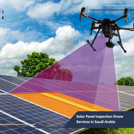
- Renewable Energy: Our solar panel inspection drone solutions integrate with GIS to map specific defective panels across massive solar farms.
- Environmental Conservation: Entities like AlUla use GIS to document and protect archaeological sites and natural reserves.
For accurate site calculations and field measurements, our drone dimensional measurement services provide a faster and more efficient solution.
How Drone GIS Services Improve Spatial Planning
Effective spatial planning is the bedrock of any successful giga-project. By integrating Drone GIS Services in Saudi Arabia into the early planning phases, developers can:
- Visualize “As-Is” vs. “To-Be”: Overlay proposed architectural designs onto current topographic maps.
- Analyze Site Suitability: Use slope and soil data to determine the safest areas for heavy construction.
- Optimize Infrastructure Placement: Plan the most efficient routes for roads, power lines, and water networks before the first shovel hits the ground.
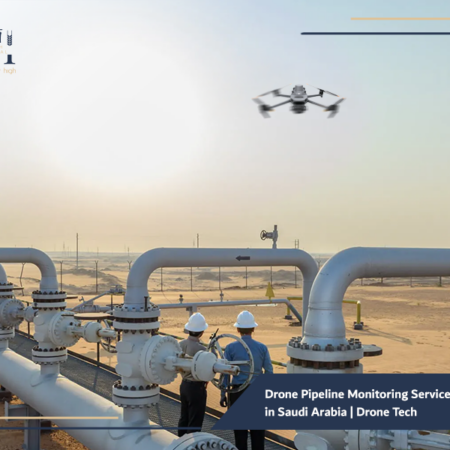
In critical infrastructure projects, drone pipeline monitoring services in Saudi Arabia help detect issues early and improve operational oversight.
Traditional GIS Data Collection vs. Drone-Based GIS
| Feature | Traditional Methods (Satellite/Ground Survey) | Drone-Based GIS (Drone Tech) |
| Resolution | Often low (30cm to 1m GSD) | Ultra-high (1cm to 5cm GSD) |
| Speed | Can take weeks for ground crews | Hours to days |
| Flexibility | Limited by satellite orbits or terrain | On-demand deployments |
| Cloud Coverage | Obstructs satellite data | Drones fly beneath clouds |
For safer and more efficient inspections in the telecom sector, see how our telecom tower drone inspection KSA solutions support maintenance and assessment.
The Role of Digital Mapping and Geospatial Analysis in Project Support
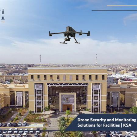
Geospatial analysis acts as a “single source of truth” for project managers. Whether it is a defense installation or a commercial skyscraper, having a geo-referenced digital map ensures that every department from logistics to site security is working from the same data. This is often integrated with drone security and monitoring solutions to provide real-time updates on site changes, ensuring compliance and safety standards are met 24/7.
If your goal is to strengthen site visibility and field oversight, our drone security and monitoring solutions offer a practical and scalable approach.
The Importance of Drone GIS Services in Digital Transformation
As part of the Saudi Digital Transformation strategy, the digitization of physical assets is a top priority. Drone GIS Services in Saudi Arabia are essential for creating “Digital Twins” virtual replicas of the Kingdom’s infrastructure. These digital twins allow for predictive maintenance, remote monitoring, and advanced simulation, moving Saudi Arabia closer to its goal of becoming a global tech leader.
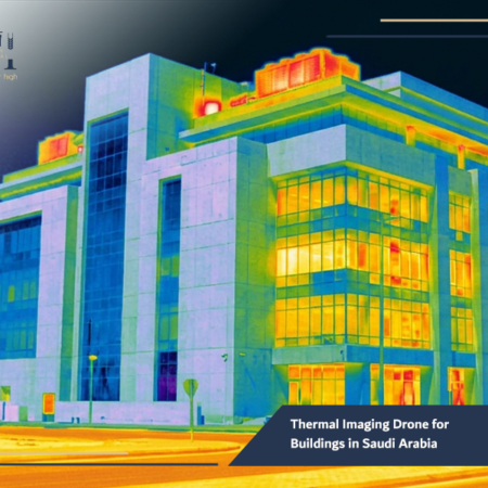
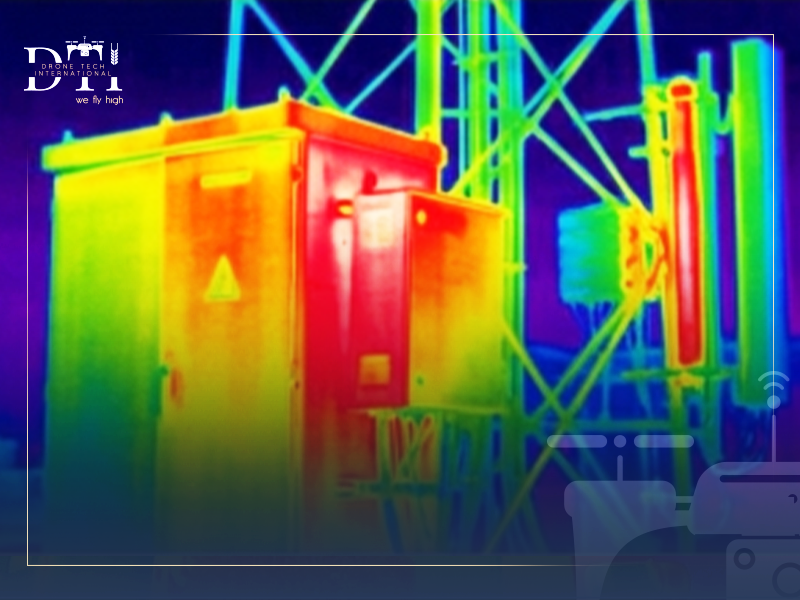
Our thermal imaging drone for buildings in Saudi Arabia helps identify hidden issues that may not be visible through conventional inspection methods.
Best Practices for Implementing Drone GIS Services in Saudi Arabia
To ensure the success of a GIS project, Drone Tech follows these industry best practices:
- Establish Ground Control Points (GCPs): Even with high-end drones, GCPs provide the necessary “anchor” to real-world coordinates for maximum accuracy.
- Choose the Right Sensor: Use LiDAR for heavy vegetation or high-resolution RGB for detailed visual mapping.
- Compliance with GEOSA: Always adhere to the General Authority for Survey and Geospatial Information (GEOSA) standards for data governance.
- Leverage Drone Rental Services: For short-term projects, using drone rental services with expert pilots can be more cost-effective than internal equipment management.
In the energy sector, solar panel inspection drone services in Saudi Arabia can improve maintenance planning and detect performance issues faster.
Frequently Asked Questions about Drone GIS Services
Is GIS data compatible with BIM?
Yes. Modern aerial survey services allow for the seamless integration of GIS data into Building Information Modeling (BIM) workflows, allowing architects to see their models in a real-world spatial context.
How long does it take to process the data?
Depending on the size of the area, initial 2D maps can often be delivered within 24–48 hours of the flight.
Does Drone Tech assist with drone manufacturing in Saudi Arabia?
Yes, we are actively supporting the local ecosystem through drone manufacturing in Saudi Arabia, ensuring our hardware is tailored to the Kingdom’s unique climate and operational needs.
The future of Saudi Arabia is being mapped today. By adopting Drone GIS Services in Saudi Arabia, you are not just getting a map; you are gaining a powerful analytical tool that reduces risk, cuts costs, and accelerates project timelines. At Drone Tech, we are proud to be the eyes in the sky and the intelligence on the ground for the Kingdom’s most ambitious projects.
Are you ready to transform your project data into a spatial masterpiece?
Contact the experts at Drone Tech today to learn how our GIS and aerial mapping and surveying solutions can support your mission. Let’s map the future together.