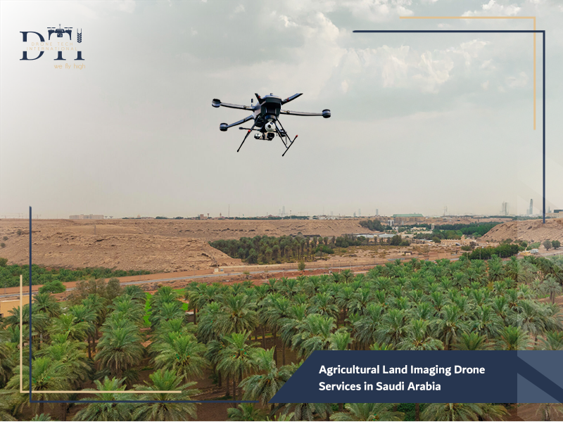
Agricultural Land Imaging Drone Services in Saudi Arabia
In line with Saudi Arabia’s Vision 2030 and its focus on food security and sustainable water management, the agricultural sector is undergoing a massive digital revolution. Traditional farming methods are being replaced by “Precision Agriculture,” where every drop of water and every gram of fertilizer is accounted for.
At Drone Tech, one of the premier drone companies in Saudi Arabia, we are leading this change by providing the Agricultural Land Imaging Drone a sophisticated tool designed to give farmers a comprehensive, data-driven view of their land.
What is Agricultural Drone Imaging?
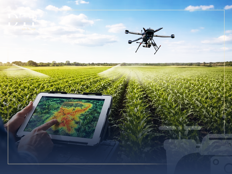
Agricultural drone imaging is the process of using unmanned aerial vehicles (UAVs) equipped with specialized sensors to collect high-resolution data from farmland. Unlike standard professional aerial photography used for media, an Agricultural Land Imaging Drone captures scientific data. By flying over vast hectares, these drones create detailed maps that reveal plant health, moisture levels, and soil variations that are invisible to the naked eye.
For advanced surveying and high-accuracy data capture, explore our LiDAR drone services for projects in KSA.
Looking for the right drone for your needs?
Explore a curated selection of drones and specialized solutions from our store.
Why Modern Agriculture Relies on Drones
The vast desert landscapes of Saudi Arabia present unique challenges, such as extreme heat and limited water resources. Modern agriculture relies on drone services in Saudi Arabia because they offer:
- Scalability: Monitoring thousands of acres in a single day, which would take weeks for ground crews.
- Precision: Identifying specific areas of stress rather than treating the entire field.
- Sustainability: Reducing the environmental footprint by optimizing the use of chemicals and water.
- Data-Driven ROI: Providing clear evidence of crop performance to guide financial investments.
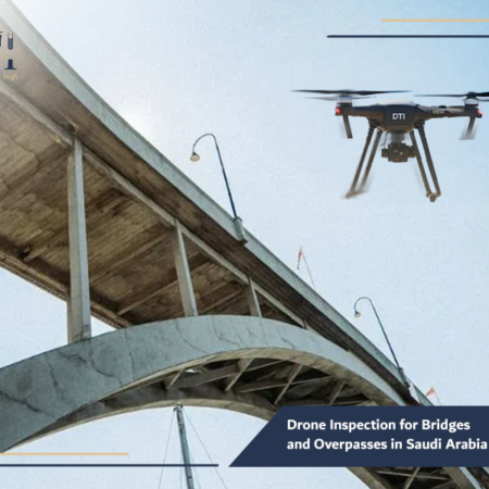
For structural assessment and safer infrastructure checks, explore our drone inspection for bridges and overpasses.
How Drones Help Monitor Crops and Analyze Soil Health
Using an Agricultural Land Imaging Drone allows for a “top-down” analysis of the farm’s lifecycle. Before planting, drones help in aerial mapping and surveying to analyze the topography of the land. This ensures that irrigation systems are designed to prevent water pooling or runoff. During the growing season, the drones monitor crop height and density, providing a real-time health check. By analyzing the soil’s spectral signature, drones can also pinpoint nutrient deficiencies, allowing farmers to apply fertilizer only where it is needed most.
To improve spatial analysis and connect field data with smart mapping outputs, learn more about our drone GIS services in Saudi Arabia.
Types of Agricultural Drone Imaging
At Drone Tech, we utilize various sensors to provide a 360-degree view of your farm:
- Visual Imaging (RGB): This is excellent for basic aerial survey services, counting plants, and inspecting physical infrastructure like fences or irrigation pipes.
- Thermal Imaging: By using a drone for thermal detection, farmers can see “heat signatures.” Since thirsty plants are warmer than hydrated ones, this is the ultimate tool for detecting irrigation leaks or water stress.
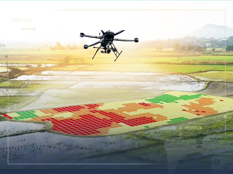
- Multispectral Imaging: This is the gold standard for agriculture. It measures how plants reflect light across different bands (like Near-Infrared). This data is used to calculate the NDVI (Normalized Difference Vegetation Index), which is a direct indicator of plant vigor and chlorophyll content.
For accurate site calculations and field measurements, our drone dimensional measurement services provide a faster and more efficient solution.
The Role of Drone Imaging in Improving Agricultural Productivity
The ultimate goal of using an Agricultural Land Imaging Drone is to produce more with less. By having access to precise maps, farm managers can:
- Predict Yields: Get accurate estimates of harvest volume weeks in advance.
- Optimize Planting Patterns: Adjust seed density based on soil quality maps.
- Improve Quality: Ensure uniform growth across the field, leading to a higher-quality harvest that fetches better market prices.
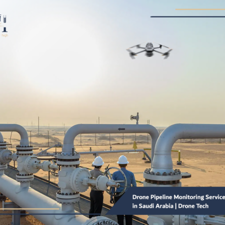
In critical infrastructure projects, drone pipeline monitoring services in Saudi Arabia help detect issues early and improve operational oversight.
Our Services
Explore DTI’s specialized drone solutions, engineering applications, and advanced technical services.
How Aerial Imaging Helps Detect Agricultural Issues Early
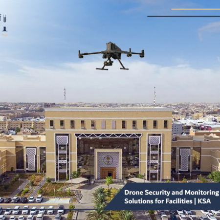
In farming, time is money. An infestation of pests or a fungal outbreak can ruin a crop if not caught in days. Drone security and monitoring solutions adapted for agriculture allow for frequent “scouting” flights.
These drones can detect the subtle changes in leaf color or temperature that signal the onset of disease long before a human scout would notice them. This early detection allows for “spot-treatment,” saving the crop while using 90% less pesticide.
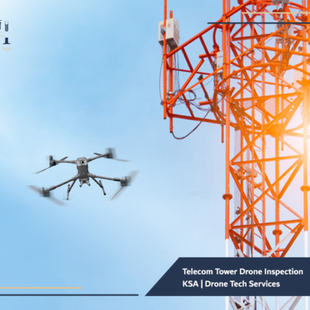
For safer and more efficient inspections in the telecom sector, see how our telecom tower drone inspection KSA solutions support maintenance and assessment.
Traditional Agricultural Monitoring vs. Drone-Based Imaging
Traditional monitoring relies on “crop walking,” where workers walk through rows to check for problems. This is slow, labor-intensive, and often misses the center of large fields. Satellite imagery is another traditional alternative, but it is often blocked by clouds and lacks the high resolution needed for individual plant analysis.
In contrast, drone services in Saudi Arabia provide:
- Immediate Deployment: Fly whenever the weather is clear, without waiting for a satellite to pass over.
- Superior Detail: See individual leaves and pests, whereas satellites see large, blurry pixels.
- Lower Costs: Eliminating the need for large manual scouting teams.
If your goal is to strengthen site visibility and field oversight, our drone security and monitoring solutions offer a practical and scalable approach.
The Importance of Drone Imaging in Resource Optimization
Water is the most precious resource in the Kingdom. An Agricultural Land Imaging Drone ensures that not a single drop is wasted. By identifying exactly which parts of a field are dry, farmers can adjust their automated irrigation systems.
This same logic applies to industrial facility inspection drone technology used on large-scale industrial farms to check the integrity of water tanks and silos, preventing costly leaks and resource depletion.
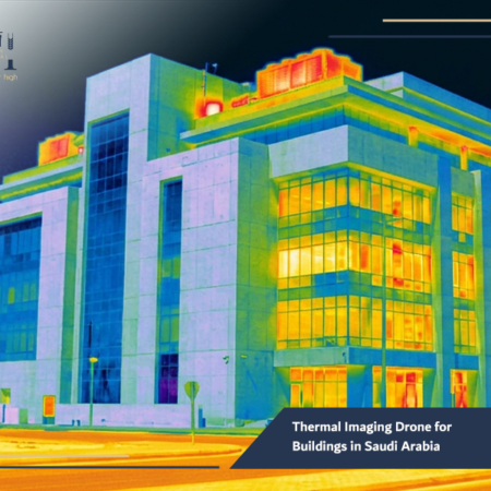
Our thermal imaging drone for buildings in Saudi Arabia helps identify hidden issues that may not be visible through conventional inspection methods.
Best Practices for Using Drones in Smart Agriculture
To get the most out of smart farming, Drone Tech recommends these best practices:
- Consistent Scheduling: Fly at the same time of day (usually around noon) to ensure consistent light for multispectral sensors.
- Integration: Link drone data with your farm management software (FMIS) to automate work orders.
- Local Support: Use drone rental services or partners who understand the local Saudi climate.
- Regulatory Compliance: Always work with drone companies in Saudi Arabia that are fully licensed by the GACA.
- Investment in Hardware: Support local innovation by looking into drone manufacturing in Saudi Arabia, ensuring your equipment is built for desert conditions.
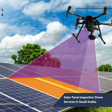
In the energy sector, solar panel inspection drone services in Saudi Arabia can improve maintenance planning and detect performance issues faster.
Frequently Asked Questions about Agricultural Drone Imaging
Can drones help with the maintenance of solar pumps?
Yes. Since many modern farms in KSA use solar energy, we offer solar panel inspection drone services to ensure your pumps are always powered by clean, efficient energy.
How long does it take to see a return on investment (ROI)?
Most large-scale farms report that the drone pays for itself within a single growing season through savings in water, fertilizer, and saved crops.
Do I need to be a pilot to use these drones?
While we offer drone rental services with professional pilots, we also provide training for farm staff if you choose to purchase your own fleet.
The transition to smart agriculture is no longer a luxury, it is a necessity for the future of the Kingdom. The Agricultural Land Imaging Drone is the most powerful tool in a modern farmer’s arsenal, providing the clarity needed to make profitable and sustainable decisions. At Drone Tech, we are proud to be the leading partner for agricultural excellence in Saudi Arabia, offering the technology, expertise, and local support to help your farm reach new heights.
Are you ready to see your land from a new perspective? Contact Drone Tech today for a customized consultation. Whether you need a one-time survey or a seasonal monitoring package, our team is ready to help you grow a better future.