Aerial Monitoring Services for Highways: Transforming Road Safety and Smart Mobility in Saudi Arabia
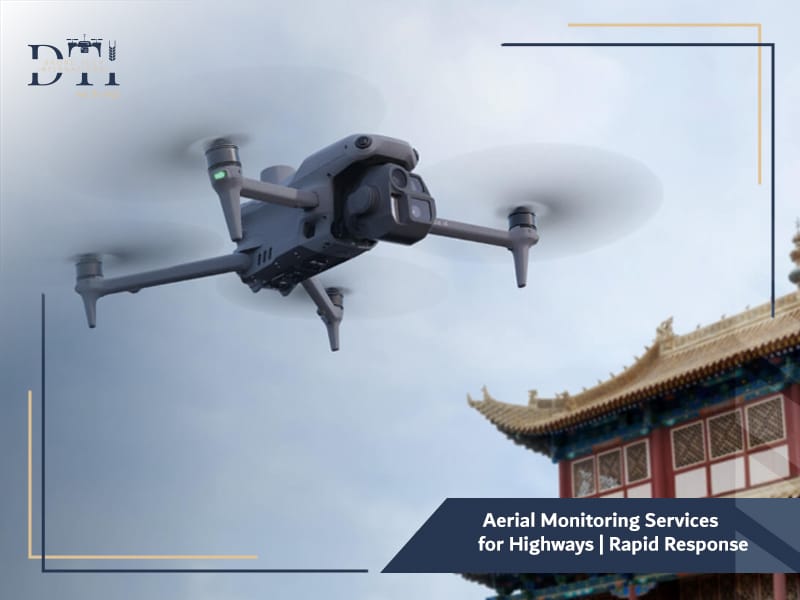
Imagine monitoring hundreds of kilometers of highways — tracking traffic, detecting incidents, and improving safety — all from the sky, That’s exactly what Aerial Monitoring Services for Highways deliver through the power of drone technology.
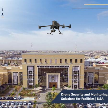
Across Saudi Arabia, where road infrastructure is expanding rapidly, drone companies are helping authorities and private operators manage highways more efficiently using real-time drone security and monitoring solutions.
At Drone Tech International, we’re proud to lead this transformation, offering advanced drone services in Saudi Arabia designed to enhance safety, reduce congestion, and support smart mobility as part of the Kingdom’s Vision 2030 initiative.
What Are Aerial Monitoring Services for Highways?

Aerial monitoring services involve using unmanned aerial vehicles (UAVs) — commonly known as drones — to observe, record, and analyze highway conditions from above.
Unlike traditional ground-based monitoring systems, drones provide a dynamic aerial perspective, allowing for continuous observation over vast distances.
These drones capture real-time images and videos, monitor traffic flow, and support incident response teams with immediate situational awareness.
Drone Tech International specializes in designing these systems for Saudi Arabia’s challenging desert terrain, integrating aerial mapping and surveying with AI analytics for maximum efficiency.
Explore our guide to the Best Drone Companies in Saudi Arabia to see what sets leading providers apart in quality, compliance, and performance.
Looking for the right drone for your needs?
Explore a curated selection of drones and specialized solutions from our store.
How Are Drones Used to Monitor and Manage Traffic Flow Efficiently?
Highway management requires constant visibility — something fixed cameras can’t always provide.
With drones, traffic authorities can gain a comprehensive aerial overview of highways, intersections, and critical routes.
Here’s how drone services are used for traffic monitoring:
- Traffic Flow Observation – Drones capture real-time footage, tracking vehicle movement and identifying bottlenecks.
- Congestion Analysis – AI algorithms analyze patterns to suggest traffic management improvements.
- Incident Detection – Drones identify accidents, stalled vehicles, or hazardous conditions.
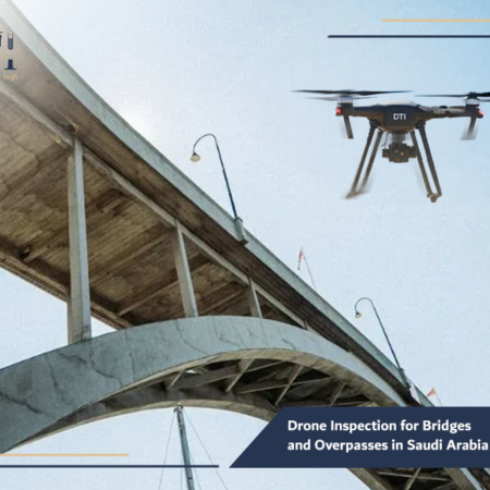
- Infrastructure Monitoring – UAVs inspect road surfaces, bridges, and barriers for maintenance needs.
Through these operations, Drone Tech International provides authorities with detailed, live insights that improve traffic efficiency and safety across the Kingdom.
Learn how Drone Services for Mining Sector help improve site monitoring, measurement accuracy, and operational planning.
What Advantages Do Drones Offer Compared to Fixed Surveillance Cameras?
While surveillance cameras have long been used for monitoring, drones bring an entirely new level of flexibility and precision.
| Feature | Fixed Cameras | Drones |
| Coverage | Limited to specific points | Wide-area coverage across long distances |
| Mobility | Stationary | Fully mobile and can relocate instantly |
| Perspective | Fixed angle | Aerial and 360° views |
| Data Capture | Static | Real-time visual, thermal, and geospatial data |
| Deployment Cost | High infrastructure costs | Cost-effective, especially for remote areas |
Drones can operate above areas where cameras are impossible to install, such as remote desert highways, mountain passes, and temporary construction zones.
This flexibility makes them ideal for highway surveillance, construction monitoring, and aerial survey services across Saudi Arabia.
Learn more about our Drone Services in Saudi Arabia and how they support surveying, inspection, and monitoring across different industries.
How Do Drones Help Detect Accidents and Support Quick Emergency Response?
In highway emergencies, every second counts — and drones are making response times faster than ever.
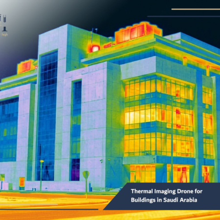
Equipped with thermal and high-definition cameras, industrial facility inspection drones can quickly detect accidents, fires, or vehicle breakdowns, even in low-visibility conditions like sandstorms or at night, Here’s how drone monitoring enhances emergency response:
- Early Detection: Drones spot incidents faster than ground patrols.
- Accurate Location Data: UAVs transmit GPS coordinates directly to control centers.
- Live Streaming: Emergency teams receive real-time visuals to assess the scene.
- Route Optimization: Traffic managers can redirect vehicles to prevent secondary accidents.
In collaboration with Saudi transport and safety authorities, Drone Tech International deploys UAVs that integrate with emergency dispatch systems — ensuring a faster, smarter, and safer response.
Read more about Drone Aerial Surveying in Saudi Arabia and how it helps improve accuracy, speed, and project efficiency.
What Is the Role of Drone Technology in Smart Road Management Systems in Saudi Arabia?
As Saudi Arabia embraces smart city development under Vision 2030, drone technology has become a key component of intelligent transportation systems (ITS).
Modern drone companies in Saudi Arabia are working with government agencies to implement aerial data into digital infrastructure networks.
Drones are now part of smart road ecosystems, where data from UAVs, cameras, and IoT sensors combine to create real-time traffic intelligence, Applications include:
- Automated highway monitoring through AI-based image recognition.
- Integration with smart traffic lights for dynamic signal control.
- Predictive maintenance by detecting early wear on bridges and roads.
- Support for autonomous vehicle navigation through aerial mapping and surveying.
At Drone Tech International, we are developing drone-based systems that align with Saudi Arabia’s goal of creating connected, sustainable road networks powered by technology.
Discover how 3D Drone Mapping Services can support better planning, visualization, and data-driven project execution.
How Do Aerial Monitoring Solutions Collect and Analyze Traffic Data?
Aerial monitoring drones collect a wide range of data — from traffic volume to vehicle behavior — using advanced imaging and positioning tools such as:
- HD and Thermal Cameras: For real-time monitoring day and night.
- LiDAR Sensors: For 3D mapping of highway terrain and infrastructure.
- GPS & RTK Systems: For pinpoint location accuracy.
Once collected, the data is processed through AI and GIS (Geographic Information System) software to extract meaningful insights, such as:
- Traffic density and speed trends.
- Accident hotspots and high-risk zones.
- Infrastructure degradation points.
This information helps transport authorities and construction companies make data-driven decisions for maintenance, traffic planning, and long-term infrastructure improvements.
Find out how an Industrial Facility Inspection Drone solution can improve safety and make asset inspections more efficient.
DRONE TECH INTERNATIONAL
Our Services
Explore DTI’s specialized drone solutions, engineering applications, and advanced technical services.
What Are the Main Governmental and Commercial Applications of Highway Drone Monitoring?
Aerial monitoring services for highways are valuable to both government entities and private operators in Saudi Arabia.
Governmental Applications:
- Traffic Management: Continuous observation and congestion control.
- Law Enforcement: Monitoring for traffic violations and illegal activities.
- Infrastructure Maintenance: Identifying wear and tear on bridges, tunnels, and roads.
- Disaster Management: Rapid assessment after storms, floods, or accidents.
Commercial Applications:
- Construction and Engineering Firms: Monitoring project progress, surveying highway extensions, and managing logistics routes.
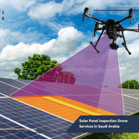
- Energy Companies: Using solar panel inspection drones for renewable energy facilities near highways.
- Logistics Providers: Tracking cargo routes and improving delivery efficiency.
Drone Tech International works with both sectors to provide tailored drone services in Saudi Arabia, ensuring compliance with GACA regulations while maintaining operational excellence.
Explore our Drone Solutions for Oil and Gas in KSA to see how drone operations support safer and smarter field inspections.
Frequently Asked Questions about Aerial Road Monitoring
Q1: Are aerial highway monitoring drones legal in Saudi Arabia?
Yes. All UAV operations are regulated by the General Authority of Civil Aviation (GACA), and Drone Tech International operates fully under these guidelines.
Q2: How high do drones fly for highway monitoring?
Typically between 60 and 120 meters, depending on visibility and the size of the monitored area.
Q3: Can drones operate at night or in harsh conditions?
Yes. Drones equipped with thermal imaging and stabilization systems can operate in low-light or windy conditions.
Q4: What data do drones provide?
They deliver real-time visual feeds, geospatial data, and traffic analytics for decision-making and reporting.
Q5: Can drones integrate with existing traffic management systems?
Absolutely. Drone Tech International offers customized integration with control centers and smart traffic systems for seamless data flow.
Read more about Aerial Monitoring Solutions for Construction Sites and how they help teams monitor progress and manage projects more effectively.
As Saudi Arabia continues to expand its road network and smart mobility initiatives, Aerial Monitoring Services for Highways have become indispensable for safety and efficiency, Drones provide unmatched flexibility, visibility, and analytical power — far beyond what fixed cameras can achieve.
By delivering real-time insights and predictive data, Drone Tech International is helping government authorities and private organizations manage roads more intelligently and safely.
Contact Drone Tech International today to explore how our drone services in Saudi Arabia can enhance your highway operations — keeping every kilometer monitored, managed, and moving safely forward.