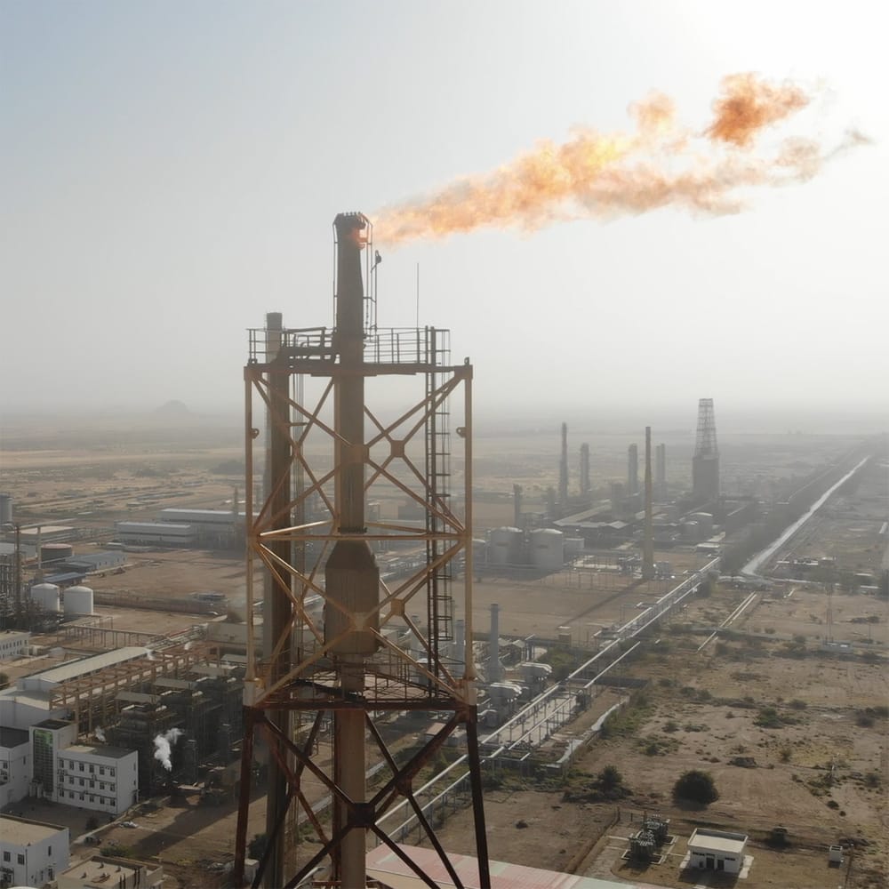
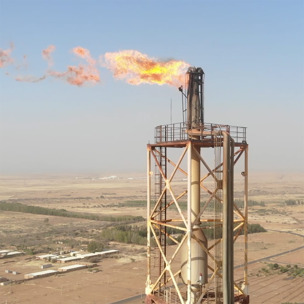
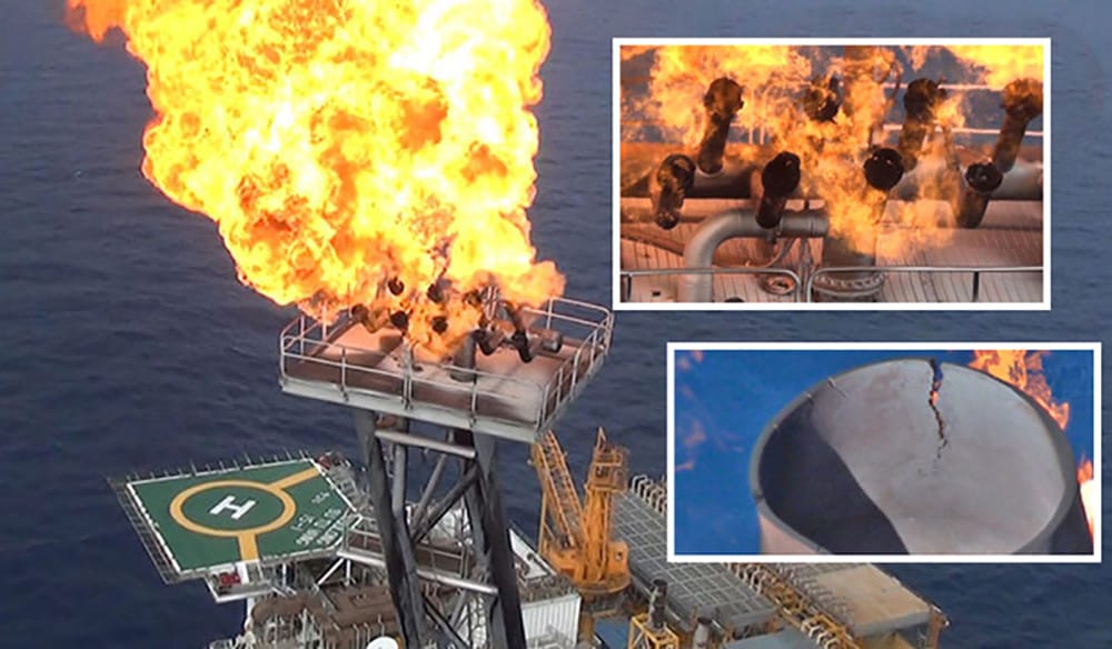
Oil & Gas Industry
In the oil and gas sector, operational efficiency, safety, and environmental compliance are crucial. Our drone services are designed to meet these needs by providing high-resolution data, real-time monitoring, and detailed analytics—all of which empower your organization to optimize operations, reduce risks, and lower costs.
Our Drone Services for Oil & Gas
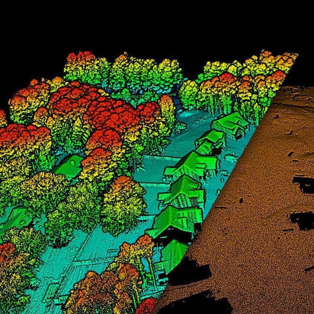
- Aerial Mapping & Surveying: Detailed orthomosaic maps, 3D point clouds, and digital elevation models created through high-resolution aerial imagery.
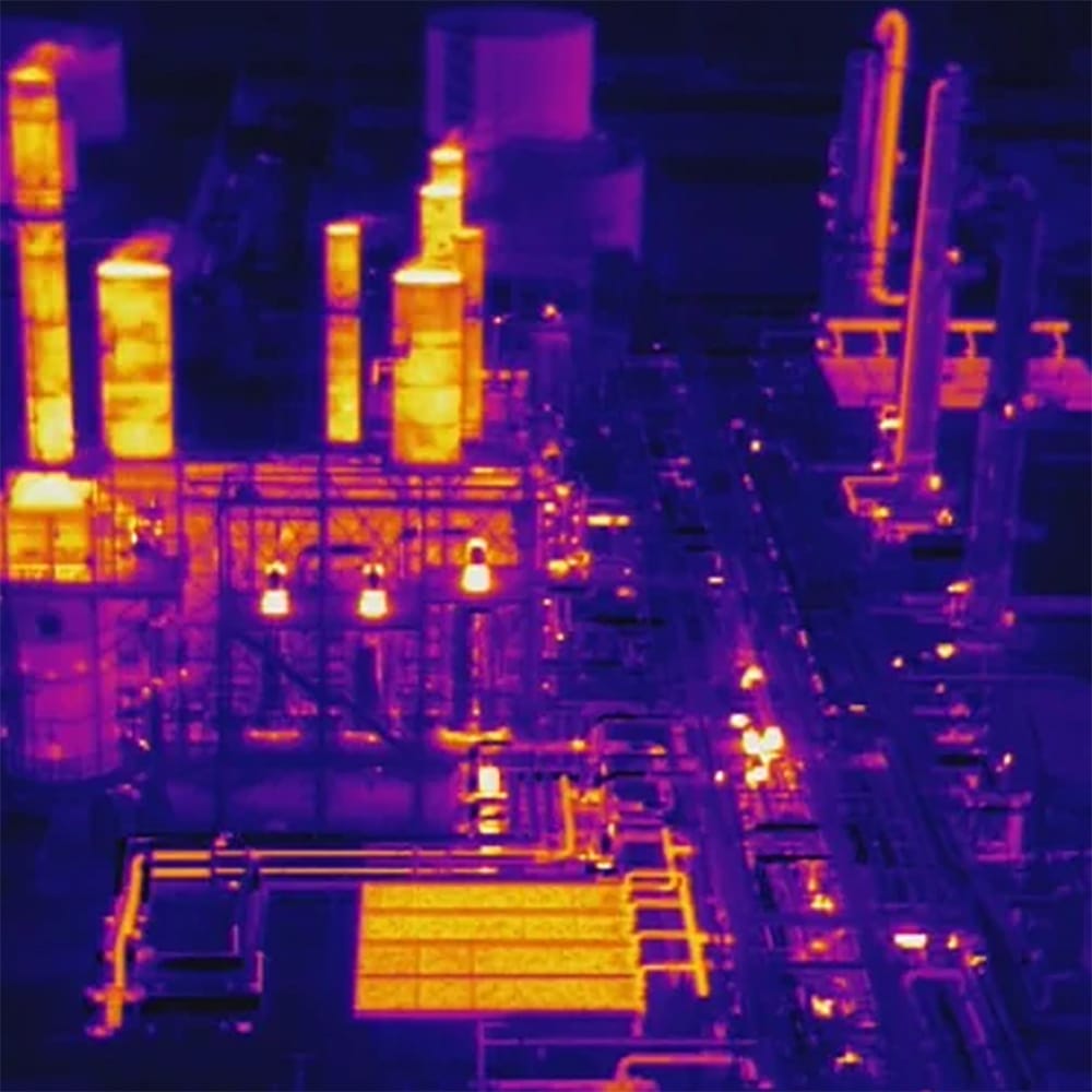
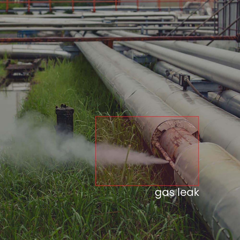
- Inspection & Monitoring: Routine and ad-hoc inspections of pipelines, storage tanks, drilling sites, and other critical infrastructure using high-definition cameras, thermal imaging, and LiDAR sensors.
- Security & Surveillance: Live monitoring and surveillance services that include real-time video streaming and sensor data integration for continuous oversight of remote or high-risk areas.
- Environmental & Compliance Monitoring: Detailed data collection and analysis to monitor environmental impacts, such as emissions or ground disturbances, ensuring adherence to regulatory requirements.
- Emergency Response & Incident Management: Quick deployment of drones for on-demand incident assessment, providing live feeds and high-resolution imagery during emergencies.
Key Benefits for Our Oil & Gas Clients
- Enhanced Safety: Remote inspections reduce the need for personnel to access hazardous areas, thereby mitigating risks.
- Operational Efficiency: Faster, data-driven decision-making improves maintenance planning and reduces downtime.
- Cost Savings: Early problem detection lowers the risk of equipment failures and operational disruptions.
- Regulatory Compliance: Detailed documentation supports compliance with industry and environmental regulations.
- Actionable Insights: Our deliverables provide the intelligence needed to optimize operations.
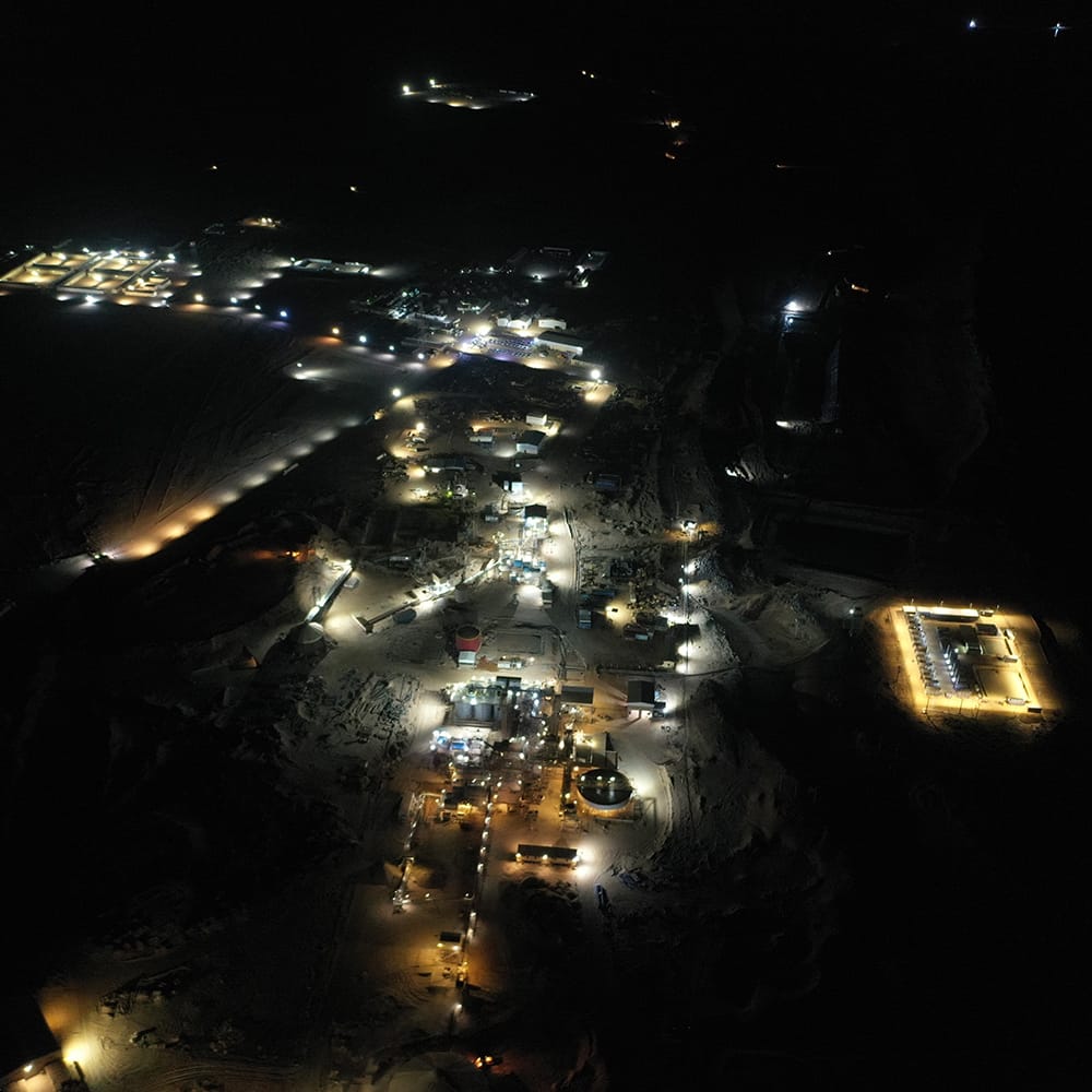
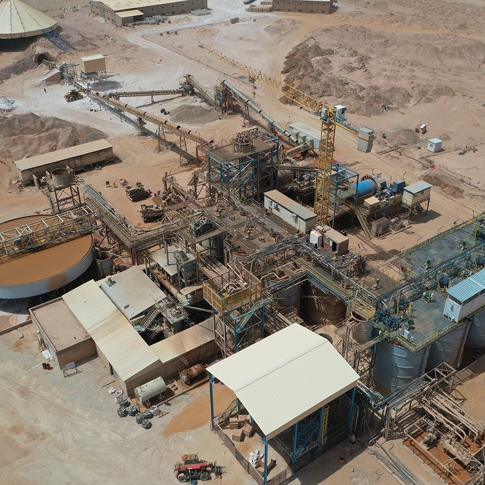
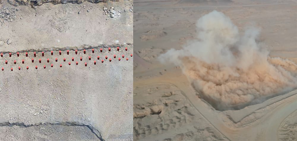
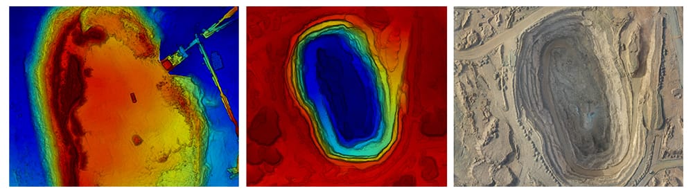
Mining Industry
Our drone solutions for the mining industry are engineered to support every stage of your operations—from exploration and site assessment to ongoing inspection and operational management. By leveraging advanced drone technology and comprehensive data analytics, we help mining companies enhance safety, streamline processes, and maximize resource efficiency.
Our Drone Services for Mining
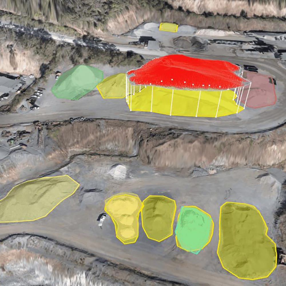
- Exploration: High-resolution aerial imagery, multispectral imaging, and LiDAR scanning for geological surveys and site assessments.
- Inspection: Routine inspections across mining sites, including pit walls and equipment, using high-definition images and thermal imaging.
- Operations: Continuous monitoring of mining operations, such as volumetric analysis of stockpiles and environmental monitoring.
Key Benefits for Mining Operations
- Enhanced Safety: Remote monitoring reduces the need for personnel in hazardous areas.
- Operational Efficiency: Streamlined data acquisition enables proactive maintenance and informed decision-making.
- Cost Savings: Reduced reliance on ground surveys and early detection of issues lower expenses.
- Data-Driven Insights: Geospatial data provides actionable insights for improved productivity.
Media Production
At DTI, we empower filmmakers, content creators, advertising agencies, and broadcasters with cutting-edge drone technology to bring a fresh, dynamic perspective to every project. Our aerial solutions are designed to elevate your storytelling, create immersive experiences, and set your productions apart.
What We Provide
- Aerial Cinematography & Photography: Capture stunning, high-resolution visuals with dynamic aerial shots that add cinematic flair to films, commercials, documentaries, and creative projects.
- Live Broadcasting & Event Coverage: Stream real-time aerial footage of live events, sports, concerts, and festivals. Our drones deliver multi-angle perspectives that enhance live production and viewer engagement.
- Advertising & Promotional Content: Produce visually captivating content that highlights products, services, and brand stories. Our drone footage is perfect for commercials, social media campaigns, and digital marketing initiatives.
- Virtual Reality & 360° Experiences: Create interactive, immersive VR content and panoramic 360° videos that offer audiences an engaging, next-level viewing experience for virtual tours and innovative storytelling.
- Location Scouting & Set Mapping: Utilize precise aerial surveys and mapping services to scout shooting locations, plan complex shots, and streamline production logistics, ensuring optimal creative and technical outcomes.
- Post-Production Support: Benefit from our end-to-end services, including expert editing, color grading, and integration of aerial footage into your final media projects, ensuring a seamless production workflow.
Value and Benefits for the Customer
- Unique Visual Perspectives: Deliver breathtaking aerial viewpoints that enhance narrative depth and captivate audiences, setting your content apart in a crowded media landscape.
- Enhanced Production Quality: Our state-of-the-art drone technology ensures ultra-high-resolution imagery and smooth, cinematic footage, elevating your project’s overall quality.
- Cost and Time Efficiency: Reduce the complexities and costs associated with traditional aerial filming methods. Our agile drone services offer quick deployment and flexible scheduling, saving you both time and money.
- Creative Flexibility: Capture creative shots from virtually any angle, opening up endless possibilities for innovative storytelling and visual expression.
- Rapid Response and Adaptability: Whether you require last-minute event coverage or adjustments to your filming schedule, our drones can be quickly deployed to meet your production needs.
- Seamless Integration: From pre-production planning to post-production editing, our comprehensive drone services integrate smoothly into your existing workflows, ensuring consistency and quality at every stage.
Our Process
- Consultation & Planning: We collaborate with your production team to understand your creative vision and technical requirements, developing a tailored drone service plan that aligns with your project goals.
- Deployment & Filming: Our expert pilots operate state-of-the-art drones to capture high-quality aerial footage, ensuring safety, precision, and a creative edge throughout the filming process.
- Data Processing & Editing: The raw footage is processed with advanced editing software. We work closely with your post-production team to integrate aerial visuals seamlessly into your final project.
- Delivery & Ongoing Support: We deliver polished, ready-to-use content and remain available for follow-up consultations or additional shoots, ensuring that your media production needs are continually met.
Integrating drone technology into your media production not only enhances your visual storytelling but also streamlines your workflow, offering unparalleled creative possibilities and operational efficiency. DTI is committed to pushing the boundaries of what's possible in aerial media production.
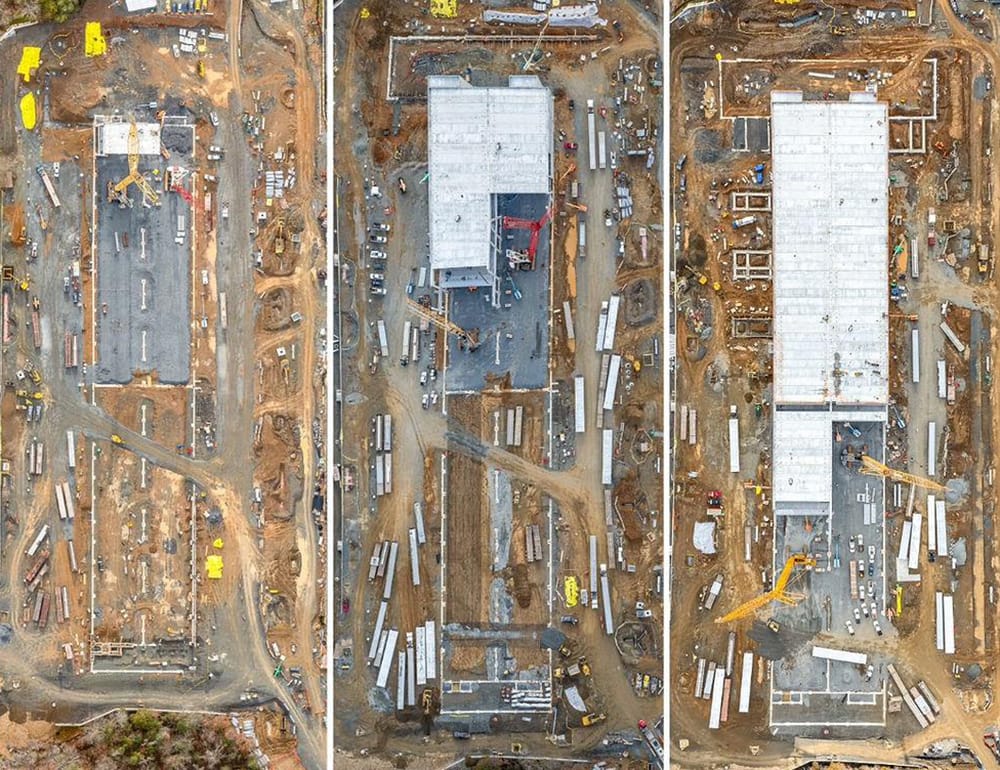
Construction Industry
DTI leverages advanced drone technology to provide solutions tailored to the Buildings, Real Estate, and Construction sectors, enhancing efficiency, safety, and cost savings.
What We Provide
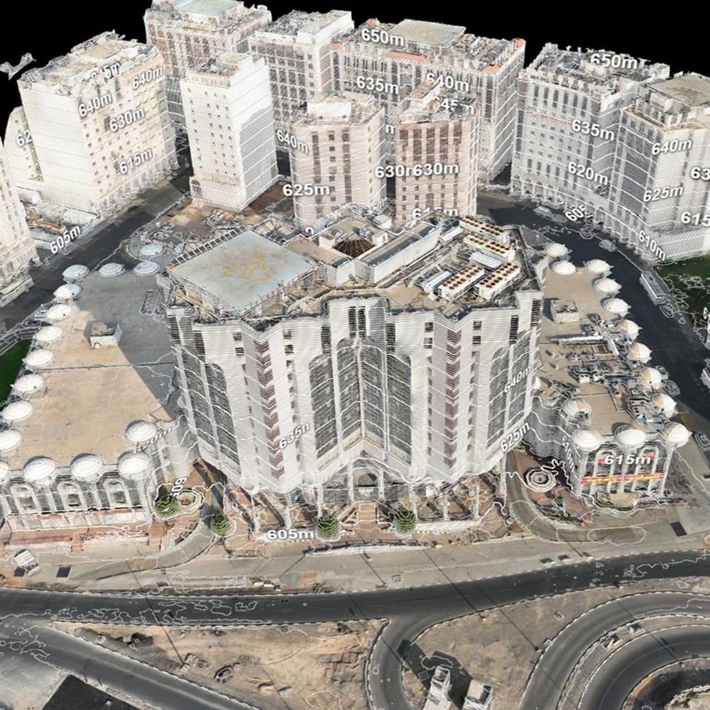
- Topographic Surveying & Mapping: Capture large-scale site layouts with centimeter accuracy.
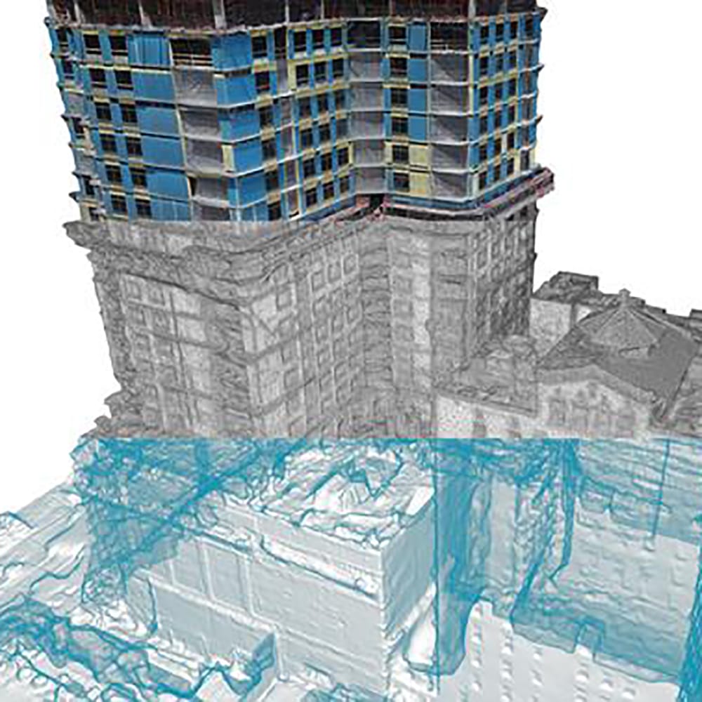
- 3D Modeling & Imaging: Create high-resolution 3D digital twins for accurate planning.
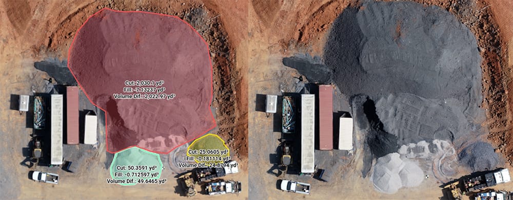
- Stockpile & Volume Measurement: Calculate cut-and-fill volumes instantly for resource planning.
- Scan-to-BIM Integration: Sync real-world data with Building Information Modeling for smarter workflows.
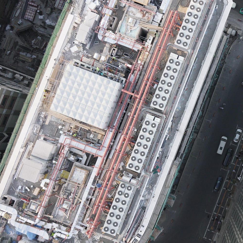
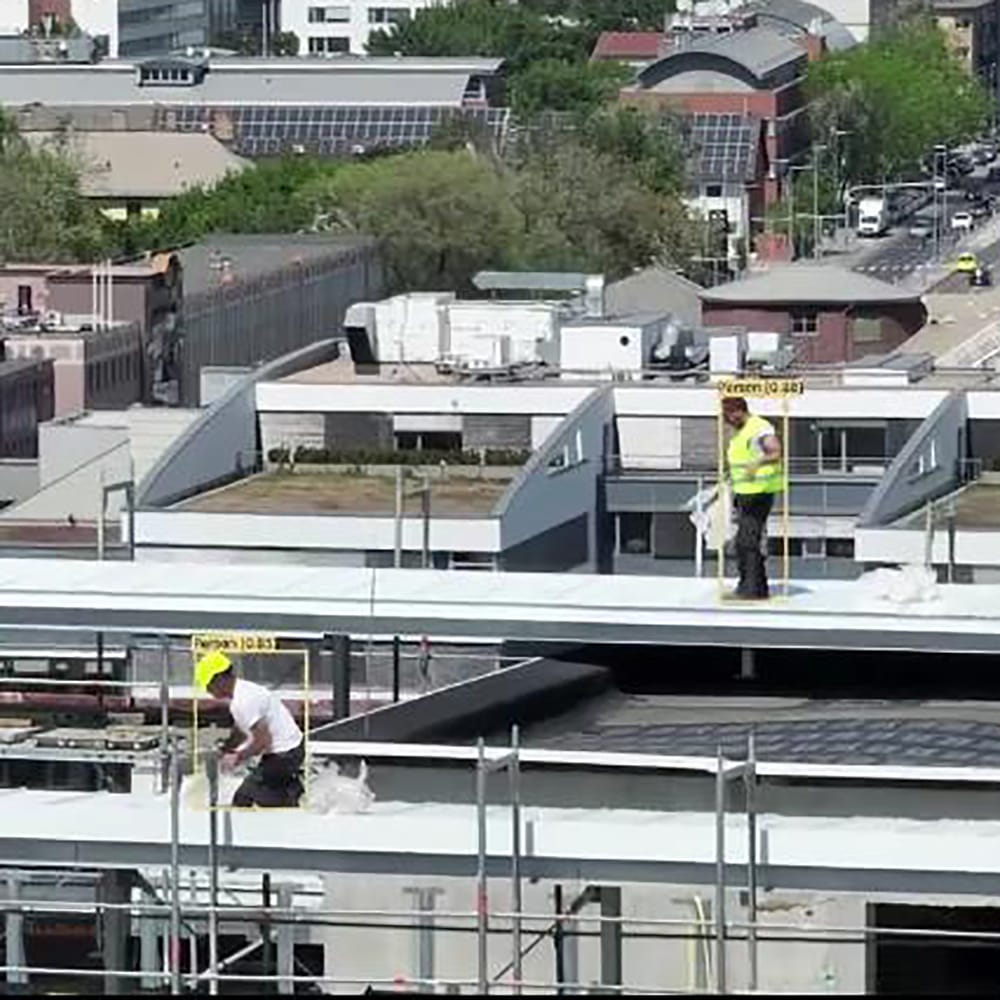
- Roof & Structural Inspections: Access hard-to-reach areas safely with aerial insights.
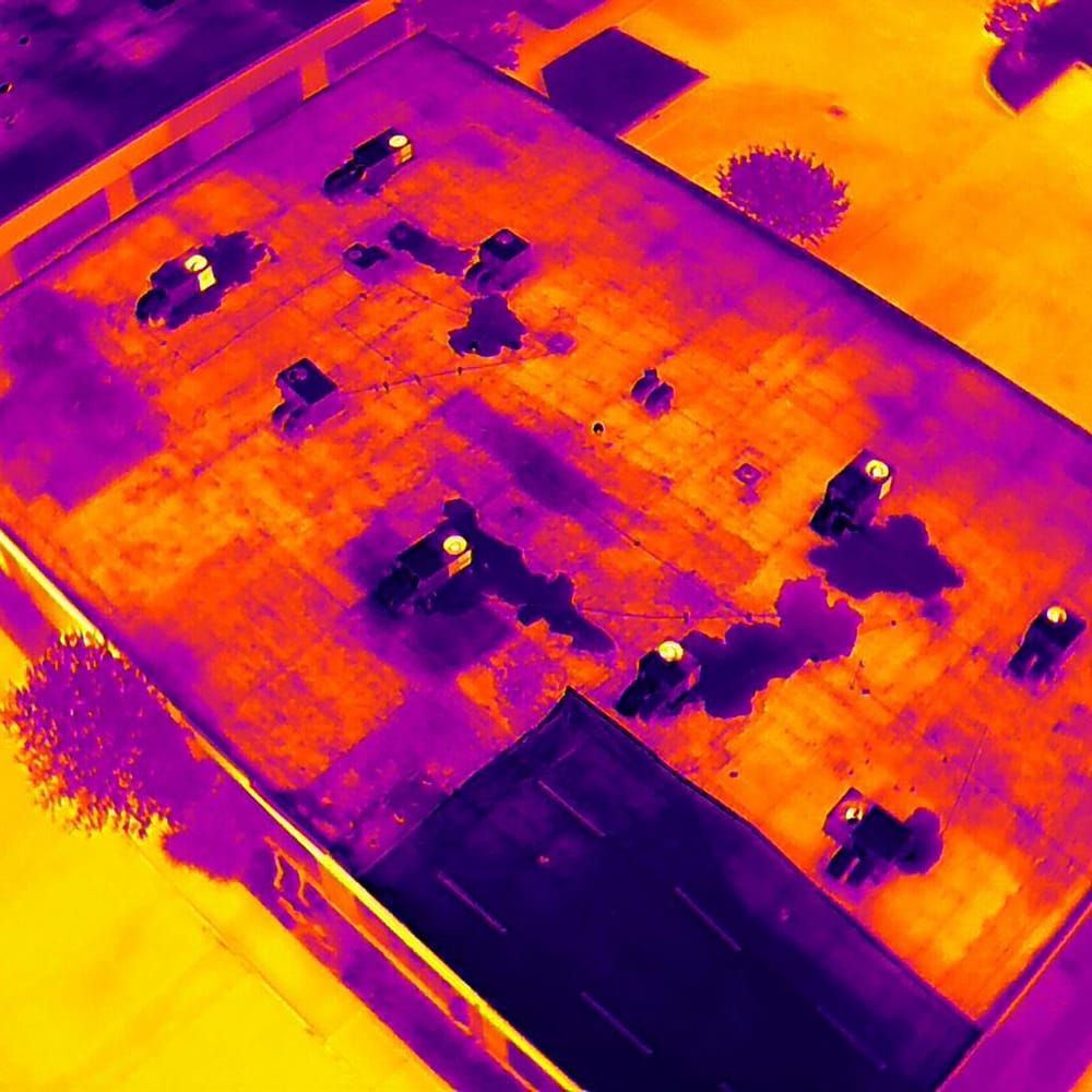
- Thermal Building Inspections: Detect heat loss, moisture, and insulation gaps.
- Construction Progress Monitoring: Visualize and track work against milestones.
- Site Security & Safety Oversight: Real-time surveillance and safety audits from above.
- Aerial Photography & Videography: Stunning visuals for documentation, marketing, and reporting.
Value and Benefits for the Customer
- Enhanced Efficiency: Faster project turnaround through automated surveys.
- Cost Reduction: Lower operational costs by minimizing on-site manpower.
- Improved Data Accuracy: Detailed data supports informed decision-making.
- Increased Safety: Drones reduce the need for manual inspections in hazardous areas.
Transportation Industry
Our drone technology revolutionizes the management and maintenance of transportation infrastructure, optimizing operations, enhancing safety, and reducing costs.
What We Provide
- Aerial Traffic Analysis: Real-time traffic flow data and congestion monitoring.
- Transportation Infrastructure Inspection: High-resolution imaging of highways, bridges, tunnels, and rail networks.
- Mapping & Surveying: Accurate 2D maps and 3D models for route planning and asset management.
- Accident & Incident Investigation: Documenting accident scenes for analysis and corrective action.
- Drone Delivery Services: Fast, reliable, and contactless transport of essential goods across complex job sites or remote locations. Our drones are equipped with smart navigation systems and secure payload mechanisms to ensure safe and timely delivery. DTI’s drone delivery solutions reduce downtime, improve logistics efficiency, and minimize human exposure in hazardous areas.
Value and Benefits for the Customer
- Enhanced Safety: Reduce the need for personnel in hazardous conditions.
- Cost Efficiency: Lower labor and equipment costs through quick, automated inspections.
- Improved Data Accuracy: High-resolution imagery supports proactive maintenance.
- Time Savings: Faster reporting and maintenance scheduling.
Defense Industry
At DTI, we understand the unique challenges and operational demands of the defense sector. Our advanced drone solutions are engineered to deliver real-time intelligence, enhanced situational awareness, and robust security—empowering defense operations with precision, efficiency, and cost-effective technology.
What We Provide
- Tactical Reconnaissance & Surveillance: Our drones are equipped with high-resolution cameras, thermal imaging, infrared, and multispectral sensors to capture real-time data. This enables covert intelligence gathering, target identification, and battlefield monitoring.
- Border & Perimeter Security: Continuous aerial surveillance solutions that monitor critical boundaries and sensitive areas. Our drones help detect intrusions, track suspicious movements, and ensure the integrity of secured zones.
- Aerial Mapping & Terrain Analysis: Utilizing advanced LiDAR, photogrammetry, and 3D modeling technologies, our drones create detailed maps and terrain models. This assists in mission planning, area reconnaissance, and strategic operations.
- Custom Integrated Systems & Specialized Payloads: We develop tailored drone platforms equipped with specialized payloads—ranging from sensor arrays to delivery systems—that can be adapted to specific defense missions, including rapid supply drops and targeted reconnaissance.
- Training & Simulation Programs: Comprehensive training and simulation exercises to help defense teams master drone operations, ensuring seamless integration and maximizing operational effectiveness.
- Rapid Response & Emergency Support: Drones primed for immediate deployment in crisis situations, providing critical situational awareness and facilitating prompt decision-making during emergencies.
Value and Benefits for the Customer
- Enhanced Situational Awareness: Gain real-time, actionable intelligence that empowers your command structure with up-to-date battlefield and operational insights.
- Improved Operational Efficiency: Streamline reconnaissance and surveillance efforts, reducing manpower needs and accelerating mission planning through rapid, precise data collection.
- Increased Personnel Safety: Minimize risk by deploying drones for dangerous missions—keeping personnel out of harm’s way while maintaining a high level of operational effectiveness.
- Cost-Effective Defense Solutions: Replace or supplement traditional manned systems with drone technology to lower operational costs and maximize resource efficiency.
- Customizable & Scalable Systems: Our solutions are tailored to meet specific defense requirements, offering flexibility and scalability that adapt as mission parameters evolve.
- Rapid Deployment & Real-Time Response: Ensure swift reaction times with drones capable of immediate deployment, providing vital support during dynamic operational scenarios.
- Robust Security & Counter-Threat Capabilities: Leverage advanced counter-drone measures and secure communication systems to defend against emerging aerial threats and maintain operational integrity.
Energy Industry
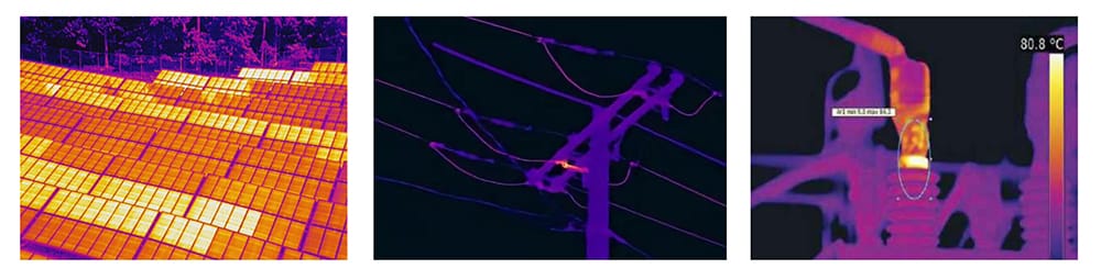
DTI provides advanced drone inspection services across multiple energy sectors, enhancing operational efficiency, safety, and maintenance planning through high-resolution visual and thermal imaging technologies.
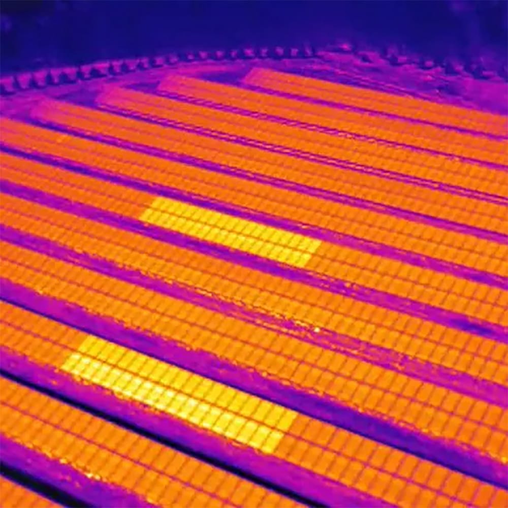
Solar Energy Inspection
DTI delivers precise drone-based inspections for solar farms using high-resolution and thermal imaging. Our drones detect panel defects, hotspots, soiling, and shading issues without interrupting operations. With fast data collection and AI-assisted analysis, we provide comprehensive inspection reports that improve energy output, reduce downtime, and support preventive maintenance planning.
- Key Services:
- Thermal imaging for hotspot detection
- Panel-level defect analysis
- Construction progress monitoring
- Orthomosaic mapping of solar fields
- Deliverables: Thermal/RGB images, annotated reports, orthomosaics, maintenance insights.
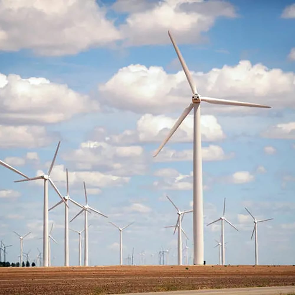
Wind Energy Inspection
Wind turbine inspections are safer, faster, and more cost-effective with DTI's drone technology. Our drones inspect blades, towers, and nacelles without rope access or cranes, capturing fine details like cracks, erosion, and lightning strikes.
- Key Services:
- Blade surface inspections
- Nacelle and tower condition monitoring
- 3D modeling of turbines for detailed review
- Deliverables: High-resolution imagery, defect tagging reports, digital twin models.
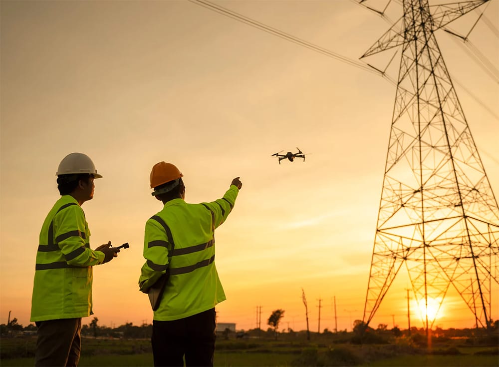
Electric Power Transmission & Distribution
DTI’s drones provide a safe and efficient solution for inspecting power lines, poles, substations, and related infrastructure. We help utilities detect faults, monitor vegetation encroachment, and assess structural integrity without risking field crews.
- Key Services:
- Power line and insulator inspections
- Powerline corridors inspection
- Vegetation management surveys
- Thermal detection of hot spots
- Substation equipment monitoring
- Deliverables: Thermal/visual imagery, annotated inspection reports, GIS layers, real-time feeds.
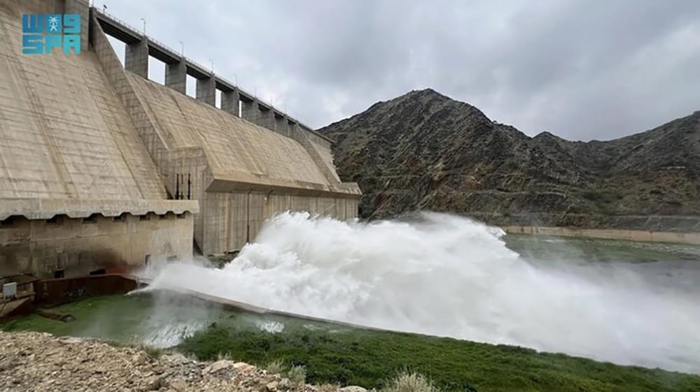
Hydroelectric Power Inspection
Drones offer a bird’s-eye view of hydroelectric structures such as dams, spillways, and penstocks. DTI conducts routine and post-event inspections to identify structural wear, cracks, and water seepage, aiding asset management and regulatory compliance.
- Key Services:
- Dam and spillway inspections
- Structural condition assessment
- Sediment and erosion monitoring
- Aerial surveys of reservoirs
- Deliverables: Orthophotos, 3D models, high-res visuals, inspection summaries.
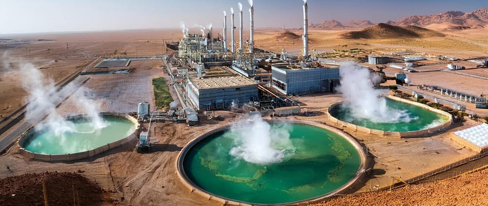
Geothermal Energy Inspection
In geothermal facilities, DTI’s drone services support the inspection of well pads, pipelines, and power plants. Thermal mapping identifies fluid leaks and surface anomalies, while visual inspection ensures infrastructure remains in optimal condition.
- Key Services:
- Aerial thermal and visual surveys
- Leak detection and surface monitoring
- Wellhead infrastructure inspection
- Environmental impact assessments
- Deliverables: Thermal maps, anomaly reports, orthomosaics, environmental data overlays.
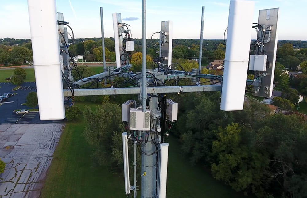
Telecommunications Industry
Drone Tech International (DTI) offers advanced aerial inspection and mapping solutions for the telecommunications industry. Our drone technology enables fast, accurate, and safe inspection of cell towers, rooftop antennas, and telecom infrastructure—significantly reducing the need for manual climbing, lowering operational costs, and improving data quality.
Key Services
- Cell Tower Inspections
- High-resolution imagery of antennas, mounts, cables, and structural elements
- Detection of rust, misalignment, damage, and wear
- Detailed condition documentation without climbing
- Tower Mapping & Modeling
- 3D models and digital twins for design, maintenance, and upgrade planning
- Structural analysis and clearance verification
- Inventory of mounted equipment (e.g., panels, RRUs, cables)
- Rooftop & Ground Site Surveys
- Inspection of rooftop telecom setups for alignment, damage, and compliance
- Aerial mapping of ground-based installations and equipment shelters
Deliverables
- Ultra-high-resolution images & video
- Annotated inspection reports with GPS-tagged findings
- 3D tower models and photogrammetry outputs
Benefits
- Enhanced Safety: Eliminates the need for technicians to climb towers
- Operational Efficiency: Faster inspections with minimal site disruption
- Cost Savings: Reduces downtime, labor, and equipment use
- Accurate Documentation: Reliable, repeatable data for audits and planning
- Network Reliability: Supports proactive maintenance and infrastructure upgrades
Agriculture Industry
We provide drone-based precision agriculture solutions that improve crop health, boost yields, and optimize resource usage.
Our Drone Services for Agriculture
- Field Mapping: Orthomosaic maps and NDVI analysis for assessing crop health.
- Spraying & Seeding: Automated aerial application of pesticides and seeds.
- Irrigation Management: Identify dry spots and optimize water distribution.
- Growth Monitoring: Monitor crop cycles and detect pest infestations early.