About Us
- Home
- About Us
About us
Who we are… and what we truly deliver
At Drone Tech International, we do not just develop drones… we build integrated operational systems powered by artificial intelligence and unmanned aerial technologies. We provide solutions specifically designed for the needs of different sectors, combining advanced aviation technologies, smart control systems, and data analytics to transform field operations into processes that are more accurate, efficient, and data-driven. We focus on developing customizable systems capable of operating in complex environments, giving our clients clearer visibility, faster decisions, and measurable results. In everything we deliver, we work to support technology localization and strengthen national capabilities, in alignment with future directions and Saudi Vision 2030.
- Vision
- Mission
Compliance and Official Certifications
We are committed to the highest standards of safety and aviation security. All our operations and systems are registered and certified by the General Authority of Civil Aviation (GACA), ensuring our clients receive fully legal and secure solutions within the Kingdom’s airspace.


Technology & Innovation
At Drone Tech International, we leverage state-of-the-art drone technology and AI-powered software to deliver precise, efficient, and data-driven solutions across various industries.

- Fixed-Wing & Multirotor Drones: Combining endurance and maneuverability for diverse applications.
- High-Resolution RGB, LiDAR & Thermal Sensors: Capturing detailed imagery and data for mapping, inspections, and surveillance.
- Autonomous Flight Systems: AI-powered route planning for efficient and error-free missions.

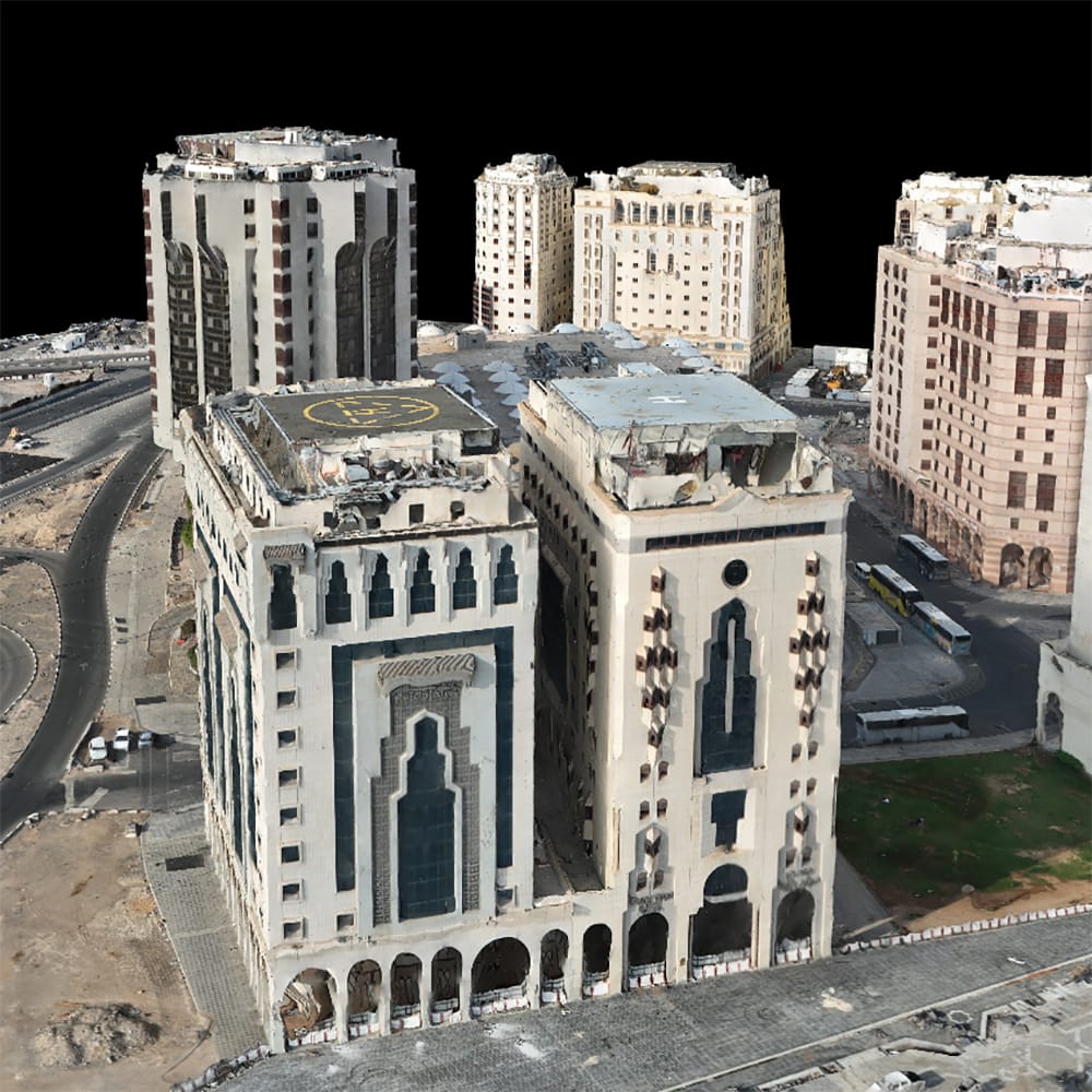
- Photogrammetry & 3D Mapping: Transforming aerial data into detailed 3D models and digital twins.
- AI-Based Image Analysis: Automatic detection of structural defects, vegetation health, and land changes.
- Cloud-Based Data Management: Secure real-time access to reports and insights.

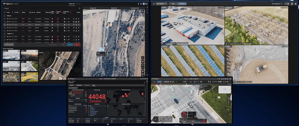
We integrate powerful drone software, including:
- Pix4D & Agisoft Metashape: High-accuracy photogrammetry and mapping.
- DroneDeploy & ArcGIS: Advanced GIS and spatial analysis.
- AI & Machine Learning Algorithms: Enhancing predictive maintenance and automated reporting.
